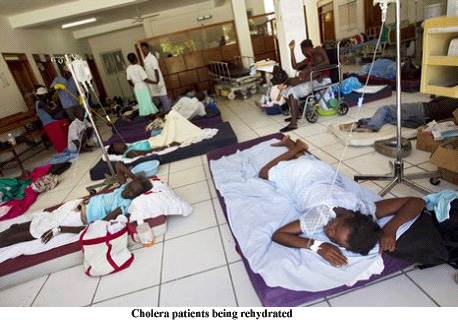
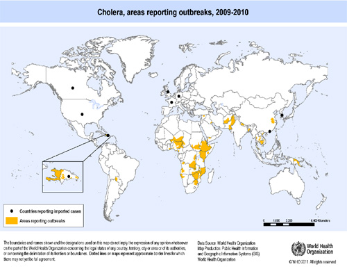
Diarrhoeal diseases are one of the major causes of death in the world. In the low income countries they are the 3rd leading cause, striking specially infants and children under five. Almost all diarrhoeal diseases are waterborne and pathogens transmitting infections include protozoa, bacteria and viruses. Cholera (due to the bacterium Vibrio cholerae) is probably the best-known among lethal diarrhoeal diseases. It has been increasing in Africa and retreating in Asia and America, although the most recent outbreak occurred in Haiti. At the end of October 2011, the cumulative number of reported cholera cases was more than 480,000, including almost 7,000 deaths. Although the spread of waterborne diseases is mediated primarily by the hydrological network, infection is also spread by individuals commuting between different places and acting as punctual sources of pathogens. In modelling terms, this requires the addition of the human mobility network on top of the hydrological one. 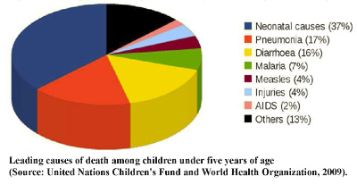 The present project focuses on advanced spatial modelling and its use for the planning and management of intervention strategies. Forecasting the space-time evolution of epidemics at various scales is crucial to designing realistic public health policies and interventions, linked to the territory where the measures are implemented. The milestones of the project are (A) the creation and analysis of a new generation of spatially explicit models of waterborne epidemics (with special focus on cholera) that include: multiple transmission modes, with several layers of spatial connectivity (river, sewage and water distribution networks; human mobility models more realistic than gravity ones and accounting also for
socioeconomic indicators, alternative modes of transportation and human behavior);(B) the development of analytical conditions for the onset of waterborne diseases, explicitly including the networks topology and the connection rules that model both hydrology and human mobility; (C) the analysis, by means of the developed modelling tools, of different intervention policies to understand the impact of decisions such as deployment of life-saving medical supplies and staff, mobility restrictions, chlorine tablets supply, sanitation improvement resulting in reduced exposure rates and access to clean drinking water and sewage systems, mass vaccinations; (D) the application of the developed models to a few selected and prototypical cases in different countries.
This research project is an International fellowship of the Swiss National Science Foundation to Professor Marino Gatto